Rapid Mapping with Frequent Revisit Times
Transparent Sky can use it's calibrated and controlled camera along with its processing to offer capabilities
that go beyond normal surveillance.
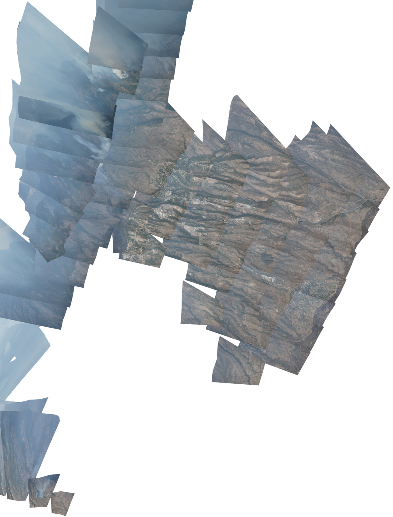
One example is "fast mapping", where large areas are mapped very quickly for the purposes of public information
and decision-making. An example of fast mapping involved the Los Conchas wildfire at Los Alamos, NM, during the
summer of 2011. This massive wildfire burned over 43,000 acres of forest, threatened facilities and safety at
the Nation's primary nuclear laboratory, as well as forced evacuations of thousands from the town of Los Alamos.
Los Alamos contracted Transparent Sky to provide up-to-date information on the fire and its potential
consequences to nuclear facilities as well as to reassure the public and homeowners of the safety of the town
and evacuated homes. Transparent Sky then made 2 photo maps per day of an area of over 100 square miles,
publishing the maps on a Los Alamos Web site. Over 1.1 million visitors consulted the site over the span of a
week to examine the scope of damage and the results of firefighting efforts. The laboratory was able to ensure
security of its facilities.
News Article
Overview image of map of Las Conchas area fire: