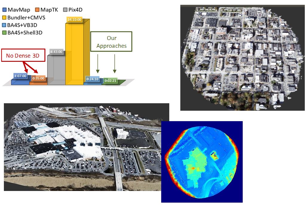
Fast 3D
Transparent Sky and its parter, the University of Missouri, has created an unprecedented 3D mapping capability.
While there are many ways to produce 3D maps from aerial images, they are very slow, requiring many hours and sometimes days
to produce a model. Transparent Sky's Real-Time 3D (RT3D) model generation allows for models to literally be created
"on-the-fly" within minutes of when the images were taken -- all using lightweight on-board processing
capabilities.
Our fast 3D maps can be used for many functions:
- Disaster relief
- Flood stage monitoring
- Tracking structural/housing damage
- Determining passability of roads
- Change detection
- Continuous construction site survey/management